
Tap into Greenwich: A curriculum shaped by time, place and discovery
- Wednesday July 8th 2026
- London Boroughs, Activities & Teaching Ideas, KS2, KS3
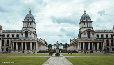
How did one London borough help shape the way we measure time, navigate the world and connect across continents?
From the Prime Meridian to the River Thames, Greenwich offers a unique lens through which pupils can explore exploration, discovery and change.
Through stories of sailors, scientists, traders and local communities, Greenwich helps bring History, Geography, Science and English to life while connecting local landmarks to global ideas.
Why teach through Greenwich?
- History – Explore royal palaces, maritime heritage and Britain's relationship with the wider world.
- Geography – Investigate the Thames, trade routes, regeneration and migration.
- Science & Maths – Discover astronomy, navigation and timekeeping.
- English – Inspire travel writing, historical narratives, debate and storytelling.
More than a borough, Greenwich is a living classroom - one that shows how a single place can shape the way we see, measure and explore our world.
Scroll this page for activities linked to...
-
Why Does the Whole World Know Greenwich?
History | Geography | STEM | KS2/KS3
Explore how Greenwich became the centre of world time and why accurate timekeeping changed travel, communication and navigation.
-
How Has the Thames Shaped Greenwich?
Geography | History | Citizenship | KS2/KS3
Investigate how the River Thames transformed Greenwich and debate what its future should look like.
-
Why Do Maps Begin in Greenwich?
Geography | Maths | History | KS2/KS3
Discover why Greenwich became the world's reference point for mapping and global navigation.
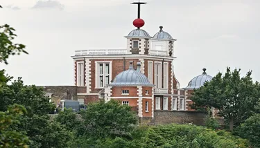
Why Does the Whole World Know Greenwich?
At a glance
Subjects: History, Geography, Science, Maths
Skills: Critical thinking, discussion, role play
Learning Focus: Timekeeping, navigation and global connections
Big Question
Why do people across the globe use a system linked to one London borough?
Starter Task (10 mins) What's the Time?
Show pupils a world map featuring London, New York, Sydney and Tokyo.
Ask:
- Is it the same time in all these places? Why not?
- How do people coordinate travel and communication across the world?
Introduce Greenwich as the historical reference point for global timekeeping.
Main Activity (35 mins)
Part 1: Why Greenwich? (15 mins)
Provide images or information cards showing:
- The Prime Meridian
- Royal Observatory
- Sailors and ships
- Maps and globes
- Clocks and timepieces
In groups, discuss:
- What is happening here?
- How are these connected?
- Why was accurate time important?
Record ideas in a class chart:
Object/Place → Purpose → Who Used It → Why It Was Important
Part 2: Become the Timekeepers (20 mins)
Assign each group a role:
- Sailor
- Explorer
- Scientist
- Merchant
- Modern traveller
Pupils discuss:
- How does accurate time help you?
What challenges would you face without it?
Why would Greenwich matter to your role?
Share findings through a short presentation or role-play.
What Pupils Will Gain
- Understanding of global timekeeping
- Insight into scientific discovery
- Appreciation of how local places can have worldwide influence
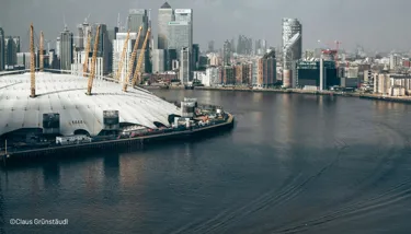
How Has the Thames Shaped Greenwich?
At a Glance
Subjects: Geography, History, Citizenship
Skills: Decision-making, discussion, evaluation Learning Focus: Rivers, trade and regeneration
Big Question
What would Greenwich look like without the Thames?
Starter Task (10 mins) Spot the Connection
Show pupils a series of images:
- The River Thames
- Cutty Sark
- Greenwich Pier
- Modern apartments on Greenwich Peninsula
- The O2
- Historic docks
Ask:
- What links these places together?
- How might the river have influenced each one?
Briefly discuss how the Thames has shaped Greenwich for centuries.
Main Activity (35 mins)
Part 1: The Thames Through Time (15 mins)
Provide groups with cards representing different periods:
- Tudor Greenwich
- Age of Sail
- Victorian docks and trade
- 20th-century industry
- Modern Greenwich Peninsula
For each period, pupils discuss:
- How was the river used?
- Who benefited from it?
- What jobs or activities depended on it?
Record ideas in a chart:
Time Period → River Use → People → Impact
Part 2: Planning Future Greenwich (20 mins)
Challenge pupils to design a new riverside development.
They must balance:
- Homes
- Green spaces
- Transport
- Tourism
- Heritage
- Wildlife
Groups present their proposals and explain who benefits, what challenges they may face and how Greenwich's character will be protected.
What Pupils Will Gain
- Understanding of how rivers influence settlement, trade and development.
- Insight into how places change over time.
- Experience evaluating different viewpoints and planning for the future.
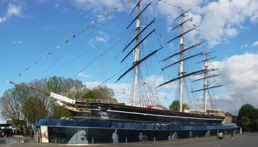
Why Do Maps Begin in Greenwich?
At a Glance
Subjects: Geography, Maths, History
Skills: Mapping, enquiry, presentation
Learning Focus: Longitude, navigation and global connections
Big Question
What would happen if nobody agreed where a map should begin?
Starter Task (10 mins) Map Mystery
Show pupils:
- A London Underground map
- A map of the world
- A smartphone map
Ask:
- What information does each map provide?
- Who might use each one?
- Why do maps need reference points?
Introduce the Prime Meridian and its location in Greenwich.
Main Activity (35 mins)
Part 1: Reading the World (15 mins)
Provide groups with a world map showing latitude and longitude.
Ask pupils to investigate:
- Where is Greenwich?
- Which countries lie east and west of the Prime Meridian?
- Why might explorers and sailors have needed this system?
Create a class chart:
Map Feature → Purpose → Who Uses It → Why It Matters
Include features such as:
- Prime Meridian
- Latitude
- Longitude
- Scale
- Compass rose
Part 2: Create Your Own Landmark Map (20 mins)
Challenge groups to create a simple map of Greenwich featuring:
- Royal Observatory
- Greenwich Park
- Cutty Sark
- River Thames
- Greenwich Market
- The O2
Maps should include:
- A title
- A key
- A compass direction
- Labels
- A short explanation of why each landmark is important
Groups present their maps and explain which landmark they believe is most significant.
What Pupils Will Gain
- Confidence in reading and interpreting maps.
- Understanding of why shared systems are important for navigation and communication.
- Appreciation of Greenwich's role in helping people understand and navigate the world.
- Experience presenting geographical information clearly and effectively.
Stay inspired and subscribe for more ideas, insights and teaching inspiration through the lens of the city's vibrant boroughs.
Subscribe to the London Classroom →Related Posts

Tap into Camden: a curriculum rooted in culture, creativity and place
Discover the power of place through London Borough of Camden - where history, creativity, diversity and urban life create rich, connected curriculum opportunities that spark curiosity, critical thinking and belonging.
Read more
London Stories, Building Storytelling Skills
If London were a book, what story would it tell? From its bustling streets and iconic landmarks to its hidden histories and quirky attractions, the capital is packed with inspiration for National Storytelling Week and beyond.
Read more
A City of Small Actions - nurture a sense of agency, responsibility, and teamwork.
Explore how small actions can shape a city through inspiring teaching ideas linked to Earth Hour and the London Eye. This blog offers flexible, classroom-ready prompts that help pupils think about sustainability, collective action, and real-world impact, encouraging discussion, critical thinking, and meaningful connections across the curriculum today and beyond.
Read more
London, the ultimate living classroom
With its unparalleled mix of history, culture and community, the UK’s vibrant capital city creates a learning resource like no other.
Read more